
Paltuding is the starting point for nearly every visit to Kawah Ijen. It is a small clearing in the forest on the eastern side of the plateau, with a ranger post, a car park and a few simple stalls, and in the middle of the night it fills with headlamps, idling vehicles and people stamping their feet against the cold. From here a single wide track climbs to the crater rim. This guide covers what to expect on that walk.
Getting to Paltuding
The trailhead can be reached by road from two directions. From Banyuwangi, the road climbs steeply through villages and forest on the eastern slopes; it is the shorter approach but has some very steep sections. From the west, roads cross the coffee country of the plateau via the village of Sempol and the plantation areas around Blawan. Both routes are paved but narrow, winding and slow at night, and in the rainy season they can be slippery. The roads up the plateau are covered in more detail in a separate story.
Most visitors arrive between midnight and the early hours, register at the ranger post and wait for the trail to open. Arrangements for registration, entry fees, opening times and any health checks are set by the authorities and change from time to time. Carry cash, since card payment is not dependable here.
The trail in numbers
The track from Paltuding to the crater rim is roughly three kilometres long and gains several hundred metres of height. The trailhead sits high on the plateau, so you are already breathing thinner air when you set out, and the rim is higher still. Most reasonably fit walkers take between one and a half and two hours to climb at a steady pace, with stops.

The path is wide, sandy and well defined, but it is not flat. The first stretch rises gently through the trees. The middle section is the steepest part of the climb, a long, steady incline that saps your legs and lungs. Around the halfway point there is a rest area with a few stalls, where the carriers' loads have long been weighed. Above it the gradient eases, the trees thin out and the path swings along the slope towards the crater rim.
On the same journeyGas, cold and the crater: staying safeTake the middle section slowly. Short steps, a steady breathing rhythm and regular brief pauses work better than rushing and then stopping for long rests. If you feel dizzy or unwell, stop, sit down and drink some water. There is no shame in turning back.
Cold nights on the plateau
Many visitors underestimate the cold. The coast around Banyuwangi is hot and humid, but the trailhead and the crater rim are high enough for night temperatures to drop sharply, particularly in the dry season, when clear skies let heat escape. Before dawn on the rim it can be near freezing, and the wind makes it feel colder.
The climb itself warms you up, so dress in layers you can adjust as you go:
- a breathable base layer that does not hold sweat;
- a fleece or light insulated jacket;
- a windproof and ideally waterproof outer layer;
- a warm hat and gloves, which make a large difference on the rim;
- long trousers rather than shorts;
- closed shoes or boots with good grip, since the sandy surface can be slippery on the way down.
A headlamp with fresh batteries is far better than a phone torch, which ties up a hand and drains your battery. A gas mask with working filters is essential for time near the crater; see the main guide to Kawah Ijen for more on the gas.
The carts on the trail
On the climb you will see wheeled carts, often pushed and pulled by two or three men, carrying visitors up the trail. Some of the men are also sulphur carriers, and the carts have become an important source of income for them. The service is useful for people who would otherwise be unable to make the climb, including older visitors and anyone with mobility problems.
Prices are negotiated rather than fixed. Agree the price for the full trip, up or down or both, before you set off, so there is no disagreement at the top. Remember that pulling a loaded cart up the steep middle section is very hard work. The story on the sulphur carriers of Ijen has more on their working lives and how to treat them with respect.
Daylight on the way down
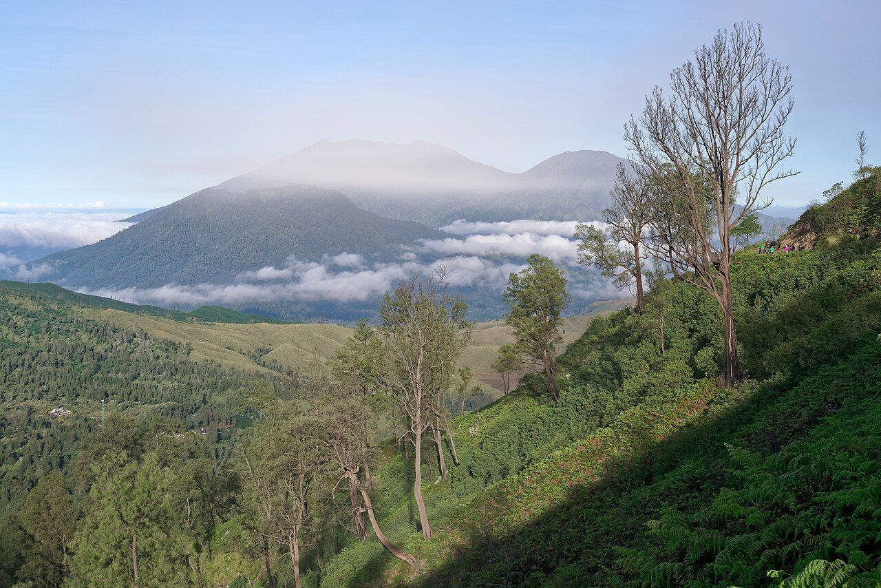
The descent in daylight reveals what you climbed through in the dark. The track winds through casuarina and other mountain forest, with wide views across the slopes of the old caldera and west to the cone of Mount Raung standing above banks of cloud. The ground is loose and sandy, so the descent can be harder on knees and ankles than the climb.

Back at Paltuding, the clearing has usually emptied out. Stalls may be open for hot drinks, and you can sit in the sun and warm up before the drive down. From here you can return to Banyuwangi, head west across the plateau's coffee country towards Bondowoso, or carry on to the coast.
Ready at Paltuding by midnight
- The crater closes when gas or volcanic activity is high, in bad weather and on scheduled days.
- Eat something before setting out and bring water and snacks.
- If you have asthma or a heart or lung condition, talk to a doctor first.
- Leave enough time for the drive; the plateau roads are slow at night.
The walk is not technical and needs no special experience, but it is a real climb at altitude in the cold and the dark. Prepared properly, it is the start of one of the most memorable mornings in Java.
Photographers on the rim
- Jakub Hałun, CC BY-SA 4.0
- Hildaniar Novitasari, CC BY-SA 4.0
- Hildaniar Novitasari, CC BY-SA 4.0