
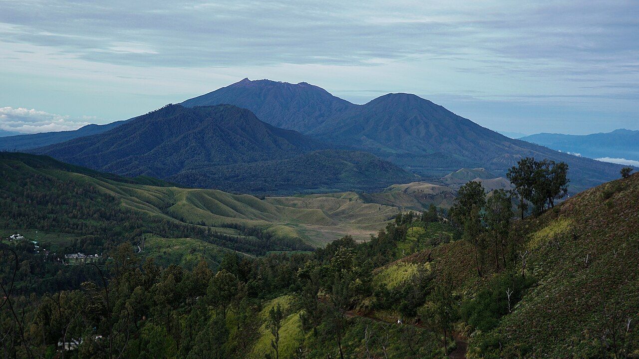
From the rim of Kawah Ijen on a clear morning, the dominant shape on the western horizon is a broad, dark volcano rising above the clouds. That is Mount Raung, one of the largest and most active volcanoes in eastern Java. It is bigger and higher than Ijen, with a summit crater of remarkable size and depth, and it has a long record of eruptions. For most visitors it is a view rather than a destination, and that is the safer way to know it.
A big volcano on the plateau's edge
Raung rises from the western side of the Ijen plateau, where the regencies of Banyuwangi, Bondowoso and Jember meet. It stands well over three thousand metres high, well above the Ijen crater rim, and its summit is a vast, deep crater with steep walls dropping towards an active vent. The mountain's lower slopes are covered with forest and, closer to the plateau, plantations.
The mountain's name is widely said to come from an old Javanese word suggesting a roar, a fitting name for a volcano that grumbles and erupts with some regularity. Its massive outline is a constant presence across much of the plateau and the lowlands around it.
Eruptions and disruption
Raung is among the most active volcanoes in Java. Its eruptions are usually of the type that throws out ash and incandescent material from the summit crater rather than large explosive events, but they can go on for weeks or months at a time. The ash is the main problem for people living nearby, coating crops, roads and roofs, and for aviation.
When Raung erupts strongly, the ash cloud can drift east and south across the Bali Strait. During some past eruptions, ash has forced the temporary closure of the international airport on Bali and other airports in the region, stranding travellers for days. If your trip to East Java or Bali coincides with a period of unrest on Raung, keep an eye on the news and on your airline's notices.
On the same journeyGas, cold and the crater: staying safeIndonesia's volcano monitoring authorities set an alert level for Raung, as they do for Ijen and the other active volcanoes in the country. That level is raised or lowered as conditions change, and with it come restrictions on how close people may go to the summit. Check the current level before you plan anything on or near the mountain.
Views from the plateau
Most people experience Raung as a view. The best of it comes from the trail to Kawah Ijen and the crater rim, where on a clear morning the mountain's cone floats above a layer of cloud filling the valleys below. The light at dawn picks out the ridges on its flanks and, when the volcano is active, a plume of steam or ash rising from the summit.
The coffee estates of the plateau give a different view, closer and from below, with the bulk of the mountain filling the sky beyond the plantation rows. The story on coffee country on the plateau covers that landscape. Clear views are more likely in the dry season and early in the morning, before cloud builds up around the summit.
Not a casual climb
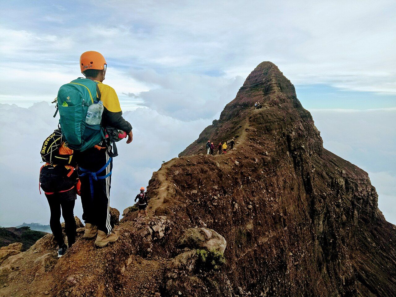
Raung is climbed, but it is not a walk to take lightly. Routes to the summit are long, typically taking more than one day, with nights spent at camps on the mountain. The final stretch to the summit crosses narrow, exposed ridges where a slip could be fatal. Climbers usually use helmets, harnesses and fixed ropes on the hardest sections, and experienced local guides are considered essential.
- Expect a multi-day trip with camping, heavy packs and limited water sources.
- Be ready for cold and wind at altitude, as well as sudden changes in weather.
- Prepare for technical sections where ropes and climbing equipment are needed.
- Expect permits, registration and access rules that change with the volcano's activity.
Climbing is sometimes banned entirely when activity increases, and trails may be closed for other reasons too. If you are seriously considering an attempt, you need real mountain experience, the right equipment, a reliable local guide and up-to-date information on the alert level. If any of those is missing, admire the mountain from Ijen instead.
Living with the mountain
The villages on Raung's lower slopes have lived beside the volcano for generations. Its eruptions bring ash and disruption, but the volcanic soils are also the reason the land is so fertile, and the coffee and other crops grown in its shadow depend on them. That mixed relationship, of risk and reward, is common to volcanic regions across Java.
If you travel through these villages, especially during or after periods of activity, be aware that ash can make roads slippery and that local people may be dealing with damage to crops and property. Respect any road closures and instructions from officials.
Planning around Raung
For most visitors, Raung matters in two ways. It is part of the view from Ijen, and it can affect travel plans when it erupts. If you are crossing to Bali after visiting Ijen, or flying out of the airport there, check for any volcanic disruption in the days before your trip. The ferry across the strait usually runs during eruptions, but flights may not.
On a clear morning on the Ijen rim, turn west and look for the dark cone in the distance. It is a reminder that the plateau is part of a living volcanic landscape, and that the mountains around it are not finished yet.
Photographers on the rim
- Avrian Priyono, CC BY-SA 4.0
- Fajar.andunisy, CC BY-SA 4.0